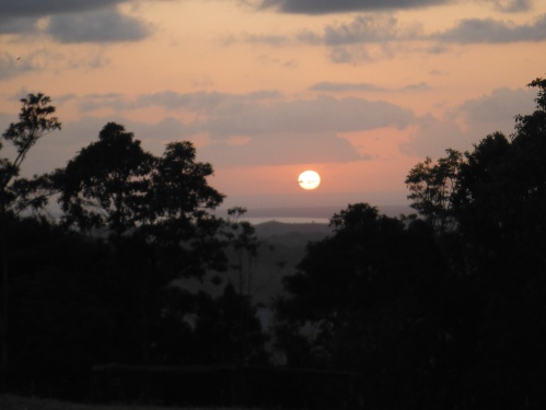
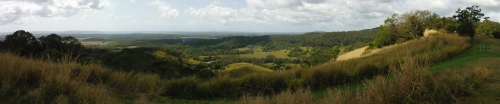
Sunrise from Tablelands Lookout
The moon was so bright overnight that it was like someone had forgotten to turn the lights off. I woke a couple of times during the night wondering whether it was already daytime. But it wasn’t and I went back to sleep. Ironically, by the time I was ready to get up, the moon had dropped low enough in the western sky to make it darker than in the middle of the night. It felt special to be out under the moon instead of locked away in a house.
Shortly after I woke, the sun rose to the east. For a short period, both sun and moon were equidistant from their respective horizons.

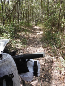
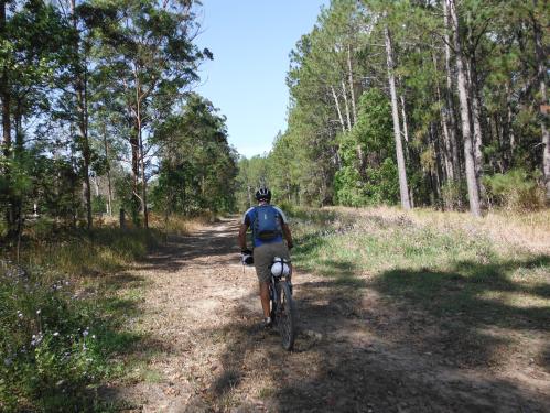
Setting off down trail #3 from Tablelands Lookout
I set off at 6:15am, following trail #3 heading towards Kin Kin. I warmed up by following a gravel road through pretty farmlands before turning off to follow a rugged and rutted fire trail into the rain forest. I lacked the skills to ride the whole trail; so deep were the washouts. But I enjoyed the serenity of a morning in the bush.
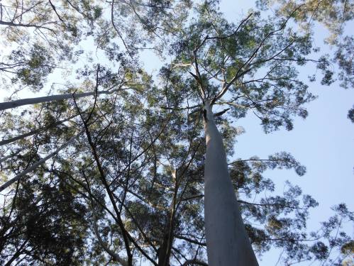
Gorgeous gums
While I spent most of my first day on the trail getting used to being out on the trails, on day 2 I was able to enjoy the total experience of being immersed in the wilderness. It’s almost as though waking up in a tent puts me in a different state of mind: a relaxed and adventurous one in harmony with nature.

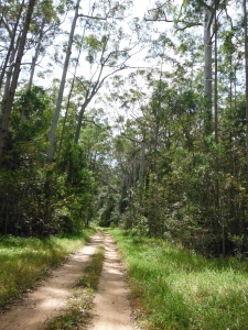
Into the rainforest
Trail #3 is as beautiful and diverse as it is challenging. Fortunately, the ride from Tablelands Lookout to Kin Kin is almost all downhill. The rainforest included some rock gardens and tree roots, as well as mostly following single trail.

Views from Johnston’s Lookout

That’s the trail running along the ridge
And then I popped out at Johnston’s Lookout. One minute I was riding in rainforest, and the next I was blessed with this fabulous view out over the range. Don’t let the green scenery trick you, it was pretty hot and dry. The trail from Johnston’s winds down a steep descent before reaching a gate and then dropping sharply downhill and along a ridge. I felt like I was cycling in the UK; or at least what I imagine cycling in the UK would be like.
There’s a trail marker missing after you exit the farm from Johnston’s Lookout. Turn left at the road and follow it for a few kilometres until you reach a sharp bend to the left as you head uphill. On the right you’ll see a locked farm gate and a trail network pedestrian gate. The trail network gate is locked shut because the fence posts have separated over time. I had to throw my bike over the farm gate and slide under the barbed wire.
This is NOT the trail
I walked up and rode down that; it was NOT the track
Once I reached the main road, I turned right into Kin Kin instead of following the 5km loop into town. I was hot and needed some electrolytes. I forgot to pack them in my gear; a mistake I won’t make again. The shop in Kin Kin has been done up since last time I was there. Eight years ago it was still just a country store with a fuel bowser out the front. Now it’s a lovely cafe with massive outdoor seating area. I can highly recommend the thick shakes.
I stopped at the camp ground in Kin Kin to collect water. While there, I had a yarn with a group of horse trail riders who were on holidays from Beaudesert, south of where I live. They often ride in my local area so I told them about the Bayview trails because you can ride horses there too. I also told them about the broken gate because they were hoping to go up towards Johnston’s Lookout from Kin Kin, and you can’t just throw a horse over a fence like you can a bike.
From Kin Kin I tried to follow the signs along trail #4. I lost it almost immediately on my way to the road because I started following farm pads. I ended up climbing up the back of a steep grassy knoll only to have to ride down the front of it and joint the road. From here, I again couldn’t find any signs to the trail so followed the Gympie-Kin Kin Road for a couple of kilometres until I got lucky by stumbling across the track. The only map I had was an enlarged version of the trail network brochure and it contained insufficient detail to navigate off accurately.

Massive goanna
Views from Cootharaba Views Lookout

Views from Cootharaba Lookout (in the other direction)
The trail started to climb uphill towards Cootharaba Views Lookout. On my way up, I managed to capture a photo of a massive goanna scrambling up a tree to get away from me. It was just one of the many goannas I saw over the weekend but was probably the largest. It hissed menacingly at me from it’s perch metres above me.
The views from the lookout were as amazing as the other views but this lookout is on a ridge so it has 360′ views. To the north and east east are Lake Cootharaba and the Cooloola Sandpatch. To the south and west west are the mountains. You can camp up here; it’s an official campsite with water but no sanitation.

Dropping down the ridge

Perfect rural roads

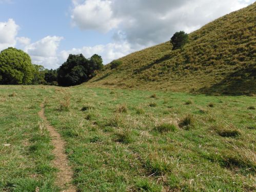
Heading to Twin Hills Lookout
From Cootharaba Views Lookout, the trail flows down along the ridgeline until it pops out on a perfect country road that winds it’s way over the hill tops until it reaches a dairy farm. From here the trail is unformed but follows the farm’s fenceline until it reaches Two Hills Lookout. It’s a challenging uphill climb across the farmland because the cows use this as their pathway to be milked. But again, it’s novel and fun to ride across a field of grass.
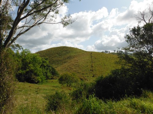
Such diversity of trail
I rode this section twice
After Twin Hills Lookout trail #4 splits from trail #2. I followed trail #4 steadily downhill towards Lake McDonald. This section of trail is abysmally marked, with missing signs at critical track junctions. When I finally did find a sign, it was the ‘Alt #4’ sign indicating the alternate dry weather route. I followed it only to discover that I traveled back on myself. Fortunately, after riding about a kilometre in the wrong direction I recognised an intersection so I took out my mobile phone and used my new favourite app (View Ranger) to work out exactly where I was and how to get to Lake McDonald. Fortunately, the track was beautiful.
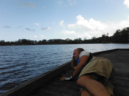
Resting at Lake McDonald
I reached Lake McDonald in the mid afternoon. I’ve been here before during both the 2012 and 2013 Adventure Race Australia. I ate lunch, enjoyed the view and relaxed for a few minutes.

Trail #7 heading back to Pomona

Ancient tree
Then I hit trail #7; my final trail for the day and one I’ve ridden and run as part of Adventure Race Australia 2012 and 2013 (I certainly hope we don’t take it again in 2014 because, no matter how beautiful the track, that would be boring for adventure racing).
Cruising back to Pomona
I made the most of that final 15km stretch back to Pomona. I felt strong and confident on my bike and actually got up some speed on the downhills. I also worked out my packing issues. Both my handlebar and seat post bags were rubbing against the wheels when I rode over jumps or through bomb holes. But after I removed my clothes from the handlbar bag and the waterproof from my seat post bag the rubbing stopped. I now now that I have to carry my clothes in my backpack.

One last look at the trail
One last section of trail to enjoy and drool over.
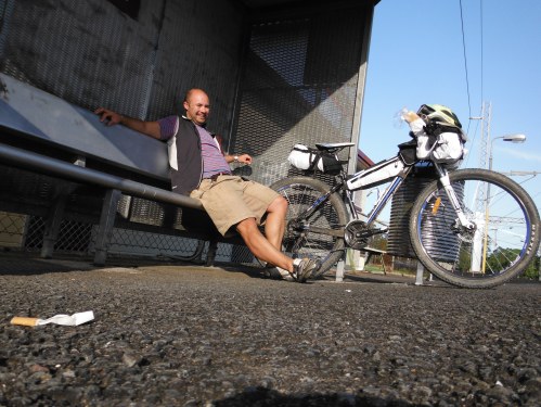
It’s all over but the 4hr train ride home
And then it was done. I got back to Pomona, bought some food and cold drink to enjoy under the shade of the same tree in the same park as I snoozed in yesterday. Then I cleaned and lubed my bike chain before my 4 hour train ride home.
As challenging as it was, it was a brilliant weekend and I’ll be back to ride the Noosa Trail Network again in November.
Total: 60km MTB
PS: Sorry for being so pick heavy but I wanted to share a good selection of images to showcase the trail network. My internet searches only revealed a relatively small number of images that made the trail network seem like they were just fire trail and gravel roads, not the diverse and beautiful experience they really are.


